All About Norman Wells
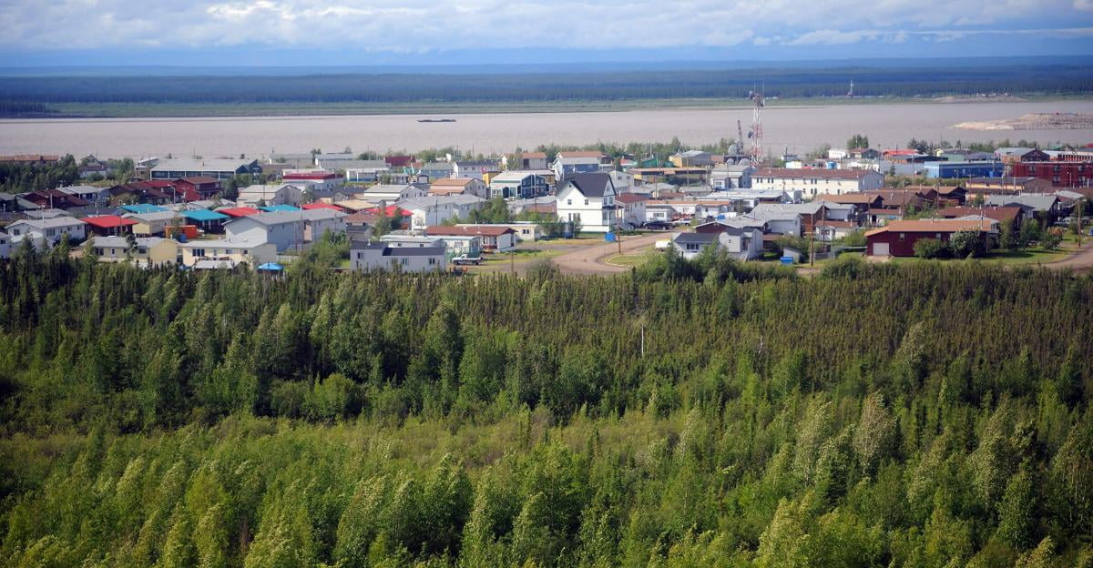
Norman Wells is located 684km northwest of Yellowknife. The Mackenzie Valley is bordered on the west by the northern part of the Rockies, and on the east, by the treeless barrens and one of the largest rivers in the world, the Mackenzie River. It is unique to the Sahtu region, because it is a non-traditional community with a mostly non-Aboriginal population. The traditional/former name of Norman Wells is Legohli (where is the oil)
According to the 2021 census, Norman Wells has a population of 673. Over 300 people in the census identified themselves as aboriginal.
Norman Wells has a subarctic climate with summer lasting for about three months. Although winter temperatures are usually below freezing, every month of the year has seen temperatures above zero. Rainfall averages 166.0 millimeters (6.54 in) and snowfall 153.4 centimeters (60.39 in). On average, there are 102.5 days, October to April, when the wind chill is below -30, which indicates that frostbite may occur within 10 – 30 minutes. There is an average of 44.6 days, November to April, when the wind chill is below -40, which indicates that that frostbite may occur within 5 – 10 minutes. For up-to-date weather in Norman Wells please visit Environment Canada.
Oil drilling and exploration continues to be a backbone of the economy. A well-developed service industry also provides services to residents and visitors to the region. The Norman Wells local economy also thrives on independently owned small businesses.
History
Unlike most other communities along the Mackenzie River, which originated as fur trading posts, Norman Wells was the first community in the NWT established solely as a result of non-renewable resource development.
Deep within the earth, beneath the glacial deposits and alluvial sands, gravels, and clays of the Mackenzie Valley, there lies a thick layer of sedimentary rocks, sandstone, shale, and limestone. Reefs and sediments laid down in shallow seas and vegetation-clogged swamps millions of years ago, now produce oil, which seeps to the surface along riverbanks.
These oil seepages gave rise to the Dene name of the area, "Legohli," meaning "where the oil is". Alexander Mackenzie noticed oil seepages when he traveled the river at the end of the 1700's. Dene from the area led geologists to the same spot in the early 1900's. Three claims were staked in 1914.
Imperial Oil acquired the claims in 1918, and the discovery well was drilled in 1919 by Ted W. Link. A small refinery was built in the early 1920's and supplied downriver communities for about 50 years. But demand, and production, was small until the 1930's, when new mining activities started at Port Radium and Yellowknife, NWT.
During World War II, the US Government became very concerned with possible Japanese attacks on west coast petroleum facilities. The US Army undertook a rush construction program, completing a pipeline from Norman Wells to Whitehorse over the winter of 1943-44. This route is known as the Canol Trail. By the time the pipeline was completed, the Japanese threat to Alaska had receded, and cheaper oil supply routes could be used, so the pipeline was turned off and dismantled in 1947.
After the war, the size of the Norman Wells operation was governed by the rate of expansion of the mining industry. In the mid-1980's, a pipeline was completed to Zama, Alberta.
In the meantime, Norman Wells has also become an important regional business and tourism centre. In the summer, the Norman Wells airport serves as a base for forest fire-fighters in the region.
Another major chapter in the region's history was written in 1994, when the government of Canada and the Sahtu Tribal Council signed the Sahtu Land Claim Agreement. The Sahtu Tribal Council represents the Hare, Sahtu Dene, Mountain Dene, and Métis people of the region. The agreement recognizes Sahtu ownership of major land parcels within the region.
Government
The Council consists of a Mayor, Deputy Mayor and six Councillors.


Emergency Services
Call 911 if you require fire, police, or an ambulance!
Where to Stay
Things to See
and DO
Norman Wells Town Council
Sahtú Got'iné
Regional Health and Social Services Centre
Sahtú Got'iné
Regional Health and Social Services Centre
History of Norman Wells
How to travel to Norman Wells
What to See
The Norman Wells area offers a wide range of activities for both residents and tourists.
Birdwatchers will enjoy spotting bald and golden eagles and sandhill cranes. There are moose, caribou, black and grizzly bears and Dall's sheep. There are endless opportunities for fishing for lake trout, arctic grayling, northern pike, whitefish, loche and inconnu -- known locally as "coney."
The Mackenzie River has always been known as Dehcho - "big river" - to the Dene. You can travel Dehcho for hundreds of miles, going upriver towards Hay River and Great Slave Lake, or downriver towards the arctic circle, Fort Good Hope, Inuvik and the Beaufort Sea. There are very fine canoeing rivers nearby in the Mackenzie Mountains.
Travel the Canol Heritage Trail
The Canol Heritage Trail provides a walk through the nearly forgotten history of one of Canada's first mega-projects, in a landscape that is both captivating and intriguing. The abandoned Canol Road winds its way for 372 km from the Norman Wells oilfield, across the broad plains of the Mackenzie River valley, through several mountain ranges, over the Mackenzie Mountain Barrens and up to MacMillan Pass on the Continental Divide, before passing into the Yukon and on towards Whitehorse. The route has now been designated the Canol Heritage Trail and has been given National Historic Site status. Seasoned adventurers may want to tackle this route on their own but guiding services can also provide tours along all or parts of the Trail.
The Mackenzie River
The Mackenzie River is one of the greatest rivers of the world. Starting at Great Slave Lake, it curls north and heads straight to the Arctic Ocean, lying for most of its journey along the feet of the Rocky Mountains.
Recreation
Norman Wells offers a variety of activities that cater to each individual’s interests. The land provides countless opportunities to be immersed in the beauty of this great northern environment. There are also many other activities including hockey teams for all ages, males and females, karate, & yoga. For information on the recreational opportunities in the town, please contact:
Town of Norman Wells Recreation Department
Box 5
Norman Wells, NT X0E0V0
Phone: 867-587-3721
The Recreation Department encompasses the arena, curling rink, community hall, swimming pool, youth and elder centre and other municipal owned recreation facilities. The Calendar of Events also lists upcoming events throughout the Town of Norman Wells.
Community Groups
There are a number of community groups that operate in Norman Wells. Please click the following link for more details: Community Groups.
Library
Norman Wells Community Library
Mackenzie Mountain School
PO Box 97
Norman Wells, NT X0E0V0
Phone: 867-587-3714
You are encouraged to visit the Norman Wells town website at: www.normanwells.com. This website is a great introduction to Norman Wells as it lists local businesses, current town updates and newsletters, and community contacts.
The Town hall office hours: Monday to Friday - 8:30am-5:00pm

